Public Lands Institute

Public Lands Institute is an ongoing photographic index of public lands. This work is dedicated to the Public Domain under the Creative Commons CC0 (Public Domain Dedication) license.

The term "public domain" encompasses those materials that are not protected by intellectual property laws such as copyright, trademark, or patent laws. No individual owns these works; rather, they are owned by the public.
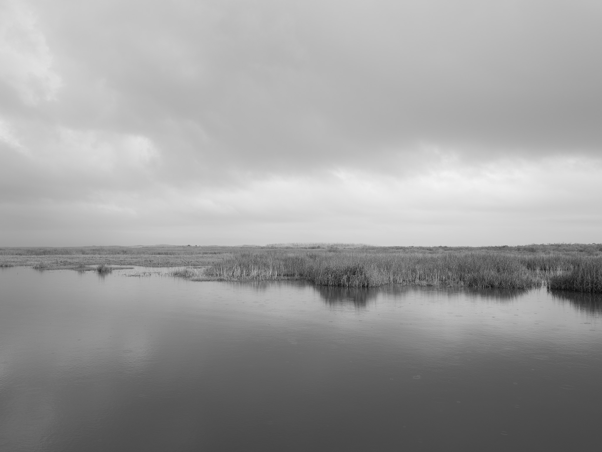
Sea Rim State Park – TX View
Geological age
~11,700 years ago – present
Epoch
Holocene (Meghalayan age); Quaternary period
Native lands
Ishak (Atakapa-Ishak) · Akokisa (Eastern Atakapa) peoples; Gulf coastal territory occupied continuously since the end of the last Ice Age
Ecology
Tidal salt marsh; chenier ridge; Gulf beach; critical migratory bird corridor (Central Flyway)
Hydrology
Gulf of Mexico shoreline; Sabine Lake; Intracoastal Waterway; tidal marsh drainage
Acreage
15,109 acres
GPS
29.6776° N, 93.9308° W
Caprock Canyon State Park – TX View
Geological age
~299–2.6 million years ago (surface strata)
Epoch
Permian through Pliocene; Quartermaster Formation (Permian, ~280 Mya); caliche caprock (Pliocene, ~5 Mya)
Native lands
Comanche (Nʉmʉnʉʉ) · Kiowa · Apache; territory of the Comancheria; Caprock Canyons part of the southern Comanche range; forced removal to Oklahoma reservations 1874–75
Ecology
Shortgrass prairie; canyon riparian; home to the official Texas State Bison Herd — last free-ranging southern plains bison lineage
Hydrology
South Prong Little Red River; Lake Theo (reservoir); playa lakes; intermittent canyon streams
Acreage
15,313 acres
GPS
33.9778° N, 101.0578° W
Palo Duro Canyon State Park – TX View
Geological age
~252–201 million years ago (exposed strata)
Epoch
Triassic (Carnian–Norian); Tecovas Formation (~225 Mya) and Trujillo Formation (~218 Mya); canyon incision began Pliocene (~5 Mya)
Native lands
Comanche (Nʉmʉnʉʉ) · Kiowa · Southern Cheyenne · Arapaho; earlier Apache; canyon occupied 12,000+ years; Battle of Palo Duro Canyon 1874 ended Comanche and Kiowa presence on the Southern Plains
Ecology
Chihuahuan Desert transition; juniper-mesquite canyon scrub; cottonwood riparian corridor; pronghorn, mule deer, aoudad sheep
Hydrology
Prairie Dog Town Fork of the Red River; ephemeral tributaries; canyon springs
Acreage
29,182 acres
GPS
34.8873° N, 101.6713° W
Johnson's Shut-Ins State Park – MO View
Geological age
~1.47 billion years ago (bedrock)
Epoch
Proterozoic eon; Rhyacian period; St. Francois Mountains rhyolite and granite among the oldest exposed rock in Missouri; river incision Quaternary
Native lands
Osage Nation (Wazhazhe) · earlier Paleo-Indian peoples; Osage hunted throughout the St. Francois Mountains; ceded territory via 1808 treaty under duress
Ecology
Ozark Highland; dolomite glades; dry chert woodland; rare endemic species in igneous glade communities
Hydrology
East Fork Black River; Taum Sauk Reservoir (upstream); shut-in pools and cascades; 2005 reservoir breach reshaped lower park terrain
Acreage
8,916 acres
GPS
37.5530° N, 90.8480° W
Elephant Rocks State Park – MO View
Geological age
~1.47 billion years ago (granite intrusion)
Epoch
Proterozoic eon; Rhyacian period; Graniteville Granite pluton emplaced during Midcontinent Rift precursor activity; spheroidal weathering forms developed over millions of subsequent years
Native lands
Osage Nation (Wazhazhe) · earlier Archaic and Woodland period peoples; Osage ancestral domain included all of southern Missouri; forced removal 1825
Ecology
Igneous glade and savanna; rare lichen communities on granite surfaces; St. Francois Mountains endemic flora
Hydrology
Headwaters of Stout Creek; ephemeral drainage between boulder fields
Acreage
132 acres
GPS
37.6370° N, 90.7260° W
Charon's Garden Wilderness Area – OK View
Geological age
~525 million years ago (bedrock)
Epoch
Cambrian period; Furongian epoch; among the oldest exposed rock in the southern Great Plains; basement exhumed through erosion of overlying Paleozoic and Mesozoic cover
Native lands
Comanche (Nʉmʉnʉʉ) · Kiowa · Wichita (Kitikiti'sh) · Apache; Wichita Mountains used as refuge and gathering ground; Comanche and Kiowa held this territory until Kiowa-Comanche-Apache Reservation established 1867
Ecology
Mixed-grass prairie; post oak savanna; granite outcrop community; federally listed black-capped vireo habitat; no mechanized access
Hydrology
Ephemeral streams draining granite uplands; vernal pools in boulder depressions; no permanent surface water
Acreage
5,723 acres
GPS
34.7260° N, 98.6880° W
Wichita Mountains National Wildlife Refuge – OK View
Geological age
~525 million years ago (bedrock); mountains re-exhumed ~300 Mya
Epoch
Cambrian bedrock (Furongian); Wichita Mountains uplifted during Pennsylvanian Ouachita Orogeny (~300 Mya), then buried and re-exhumed — one of the most geologically complex mountain histories in the U.S.
Native lands
Comanche (Nʉmʉnʉʉ) · Kiowa · Wichita (Kitikiti'sh) · Apache · Fort Sill Apache; Quanah Parker (Comanche) called the Wichitas home; mountains set aside from Kiowa-Comanche-Apache Reservation lands in 1901
Ecology
Mixed-grass and shortgrass prairie; cross timbers; American bison herd (reintroduced 1907, ~650 animals); longhorn cattle; Rocky Mountain elk; prairie dogs
Hydrology
Parallel streams draining east; Lake Elmer Thomas; Quanah Parker Lake; Comanche County watershed
Acreage
59,020 acres
GPS
34.7690° N, 98.6730° W
John Bryan State Park – OH View
Geological age
~430–420 million years ago (bedrock); gorge carved ~12,000–14,000 years ago
Epoch
Silurian period (Llandovery–Wenlock); dolomite formed in shallow tropical sea; gorge incised during Late Pleistocene and early Holocene by glacial meltwater drainage
Native lands
Shawnee (Shawanwaki) · Miami · Adena and Hopewell cultures (500 BCE–500 CE); Little Miami River corridor a major Shawnee territory; Shawnee ceded Ohio lands via Treaty of Greene Ville 1795
Ecology
Gorge microclimate supporting relict northern plant communities; Canadian yew, white cedar, walking fern — species absent from surrounding landscape; National Natural Landmark
Hydrology
Little Miami River (Ohio State Scenic River; National Wild & Scenic River); Yellow Spring iron-rich seep; Jacoby Creek tributary
Acreage
752 acres (park); 268 acres (Clifton Gorge SNP)
GPS
39.7960° N, 83.8310° W
Hocking Hills State Park – OH View
Geological age
~330 million years ago (sandstone); caves and gorges carved ~14,000–18,000 years ago
Epoch
Mississippian period (Osagean–Meramecian); Black Hand sandstone deposited in deltaic system; recess caves and gorges formed by Pleistocene periglacial weathering and glacial meltwater during Wisconsin glaciation
Native lands
Shawnee (Shawanwaki) · Delaware (Lenape) · Wyandot (Wendat) · Adena (700 BCE–100 CE) · Hopewell (100 BCE–500 CE); 'Hockhocking' a Shawnee/Delaware place name; all tribes removed from Ohio by 1843
Ecology
Hemlock-dominated gorge; Canadian hemlock at southern range limit; rock shelter communities; old-growth hemlock remnants; high biodiversity microclimate
Hydrology
Old Man's Creek; Queer Creek; Cedar Fork; multiple seasonal waterfalls; cave seeps maintaining year-round moisture; Cedar Falls (50 ft wide)
Acreage
2,356 acres (park); adjacent 9,267-acre Hocking State Forest
GPS
39.4354° N, 82.5408° W
Arc of Appalachia – OH View
Geological age
~485–420 million years ago (bedrock)
Epoch
Ordovician and Silurian periods; limestone and dolomite deposited in shallow Iapetus Ocean; terrain never covered by Pleistocene glaciation — landscape continuity extending back millions of years
Native lands
Shawnee (Shawanwaki) · Adena and Hopewell mound-building cultures; unglaciated Adams County at southern edge of Shawnee territory; proximity to Serpent Mound (Adena/Fort Ancient, ~300 BCE–1200 CE)
Ecology
One of the most biodiverse landscapes in Ohio; 114 rare or endangered species; dry limestone prairie (Lynx Prairie); eastern red cedar savanna; unglaciated forest; relict Appalachian flora
Hydrology
Brush Creek watershed; Rocky Fork Creek; numerous limestone seeps and springs; Serpent Mound crypto-explosion structure (nearby)
Acreage
7,000+ acres across preserve system
GPS
38.8200° N, 83.5400° W
Yellow Springs / Clifton Gorge – OH View
Geological age
~430–420 million years ago (bedrock); gorge carved ~12,000–14,000 years ago
Epoch
Silurian period (Llandovery–Wenlock); same dolomite formation as John Bryan; Yellow Spring iron precipitation an active Holocene process — ongoing mineral deposition visible as orange staining
Native lands
Shawnee (Shawanwaki) · Miami · Adena culture; Yellow Spring a known waypoint on Shawnee trail networks; Little Miami River a principal Shawnee waterway
Ecology
Gorge relict communities: cliff-face ferns, walking fern, Canadian yew; spring wildflower corridor; National Natural Landmark (Clifton Gorge); old-growth tree remnants in Glen Helen
Hydrology
Little Miami River (National Wild & Scenic River); Yellow Spring iron seep; Jacoby Road wetlands; Bryan Park spring complex
Acreage
268 acres (Clifton Gorge SNP); 1,000+ acres (Glen Helen)
GPS
39.8030° N, 83.8880° W